|
|
|


Original Map scanned from the book The Book A Voyage from England to India
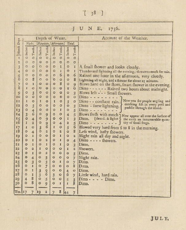
Bombay Weather During June, July, Aug, Sep and partial October -1756
Observe the author's weather diary—he has recorded the water depth at night, forenoon, and afternoon, though the specific gauge used is unclear. The meticulous daily weather observations are truly fascinating, even though temperature readings are absent. A summary of all five months is provided in the final snapshot.
Now, Mumbaikars must compare today's weather conditions with those of 1756 and comment on whether climate change is evident 😃
Note: Something like f has been used instead of S (Ex. Flight for Slight and Fhowers for Showers)
 |
 |
 |
 |


No comments:
Post a Comment